QINling passive SEISmic project (QINSEIS)
秦岭及周边地区地震探测
Intruduction/简介
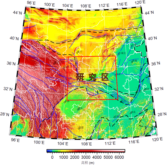 Study region / 研究区图 |
As a part of the larger projects of Sinoprobe and 3D Geological Mapping in China, QINSEIS (2011-) is deploying broadband seismometers to image the three-dimensional crustal and lithospheric structure beneath the Qinling Mts. and surounding regions, e.g., Dabashan Mts., north Sichuan basin, south Ordos basin. These images will provide insights into what is relation among the blocks such as Ordos basin, Sichan basin and northeastern Tibetan plateau, and how they take action among each other.
做为中国地壳探测计划和中国地质调查局全国三维地质填图工作的一部分,QINSEIS旨在通过在秦岭及周围地区进行宽频地震流动台站观测来探测有关地区的深部结构。这些地区包括了四川盆地的南缘、鄂尔多斯盆地的北缘和整个大巴山地区。这些研究将展示该区域主要构造块体(例如,鄂尔多斯盆地、四川盆地和青藏高原东北缘等)之间的关系,以及这些块体间相互作用方式。
Progresses(2011-2012) / 工作进展(2011-2012)
Till Sept. 2012, we installed 140 BB/VBB seismic stations (70 BB and 70 VBB) in the study region, all the stations can be found in the figure of seismic stations.
直到2012年9月,我们已经在研究区安装了140个宽频和甚宽频地震台站,台站分布见地震台站分布图。
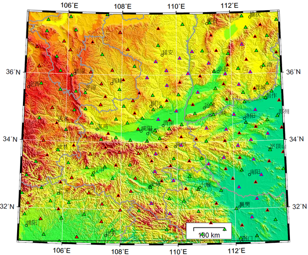 Seismic stations / 地震台站分布图 |
Participants / 参加单位
QINSEIS project is led by Seismology Lab of Institute of Geomechanics - CAGS. This project is opened for all seismological groups and seismologist, and we welcome any seismologist or seismological group participat our field work or seismic data analyses. / QINSEIS探测工作是由中国地质科学院地质力学研究所天然地震实验室负责并组织的。我们整个工作对任何天然地震研究工作者和研究组是开放的,并欢迎大家参与到这个计划中来。
Primary participants / 主要参加单位:
- Sinoprobe - Chinese Academy of Geological Sciences / 中国地质科学院深部探测中心
- Seismology Lab. - Institute of Geomechanics, CAGS / 中国地质科学院地质力学研究所天然研究组
- School of earth and space science, Peking University / 北京大学地球和空间科学学院
Participants in partial works / 以下单位参加了部分工作: